
Introduction to a 6-Part Series on Mapping
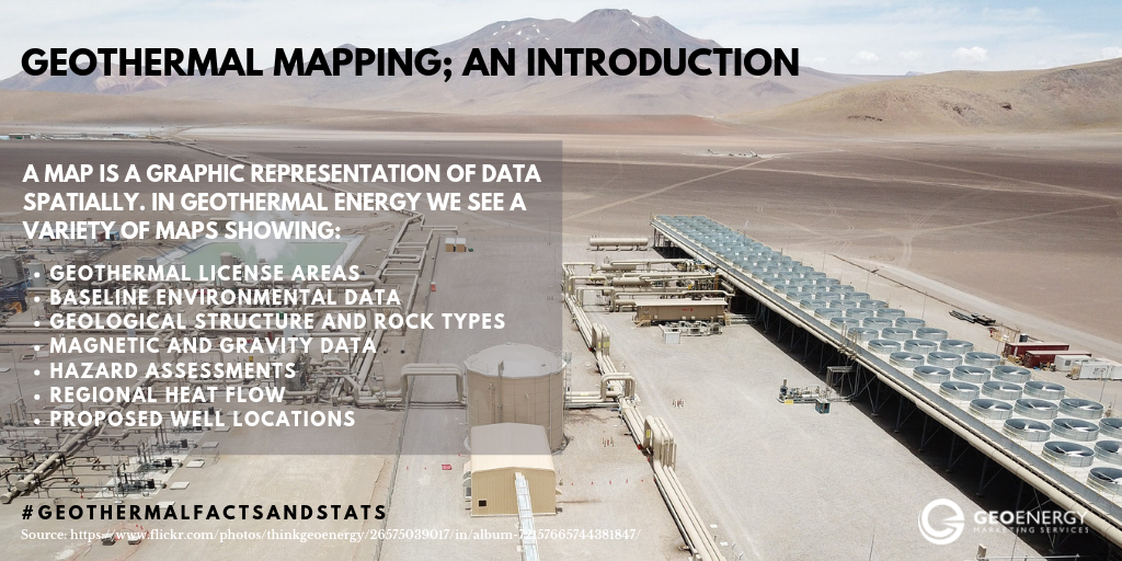
Mapping has become a powerful tool that has been applied to many aspects of our societies. A map is a graphic representation of data spatially. In geothermal energy we see a variety of maps showing:
- geothermal license areas
- baseline environmental data
- geological structure and rock types
- magnetic and gravity data
- hazard assessments
- regional heat flow
- proposed well locations
However, the data necessary to produce these maps have been lacking in regions with geothermal potential. For example, a report by Lebel (2009) recommended the need for more geoscientific data and maps in order to understand the geothermal resources of Western Canada. Also, an open letter by European Geothermal Energy Council (2018) stated that ‘New geological data are the key to create momentum in the development of geothermal energy’.
But what is geothermal energy and how do we harness it? Geothermal energy is thermal energy stored in the Earth i.e. underground heat. It can be utilized in three ways:
- Geothermal heat pumps- harnesses elevated ground temperatures
- Direct use and district heating (50 deg c to 100 deg c) that is used for spas, heating and cooling of buildings and also in agriculture (e.g. green house in Netherlands); and,
- Power generation that uses high temperatures generally above 100degc and takes a number of forms including conventional resources, hot sedimentary aquifers and enhanced geothermal systems.
In order to develop these geothermal resources, we must answer these questions – What area/region is most favorable? Where exactly do we drill? What is the extent of the reservoir (depth and spatial extent)? To answer these questions, we must first understand the critical aspects of geothermal systems, heat (resource), water (medium), flow and permeability. This requires a variety of scientific studies producing results that can be presented as the maps mentioned earlier.
Today, a number of technologies exist which give us the ability to collect a vast amount of data (geochemical; geological; geophysical) to create maps. This #GeothermalFactsandStats blog series will focus on the utilization of geological, geochemical/hydrogeological and geophysical maps and their importance as tools to aid our development of geothermal energy globally.
Now that we’ve introduced mapping in geothermal energy, check back next week when we share more about geological mapping in geothermal energy.
Sources
International Geothermal Association Service GmbH, 2014, Best Practices for Geothermal Exploration, c/o Bochum University of applied Sciences (Hochschule Bochum), Lennershofstr, 140, D-44801, Germany, 195 pages.
Lebel, Daniel (editor) 2009, Geoscience Needs for Geothermal Energy Development in Western Canada: Findings and Recommendations, British Columbia Ministry of Energy, Mines and Petroleum Resources, Petroleum Geology Open File 2009-03, 18 pages.
Netherlands – Geothermal as key element to green up greenhouse operations, published March 07, 2019 http://www.thinkgeoenergy.com/netherlands-geothermal-as-key-element-to-green-up-greenhouse-operations/ ; accessed on March 07, 2019
European Geothermal Energy Council (2018), European Call For An Increased Use Of Geothermal Energy Published November 28, 2018, https://www.egec.org/media-publications/open-letter-european-call-increased-use-geothermal-energy/ ; accessed on March 07, 2019
Stober, I., and Bucher, K., 2013, Geothermal Energy: From Theoretical Models to Exploration and Development, Springer-Verlag Berling Heidelberg, 291 pages, DOI 10.1007/978-3-642-13352-7
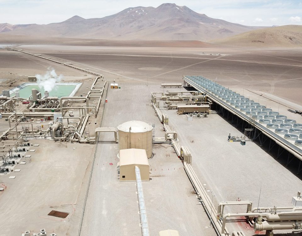
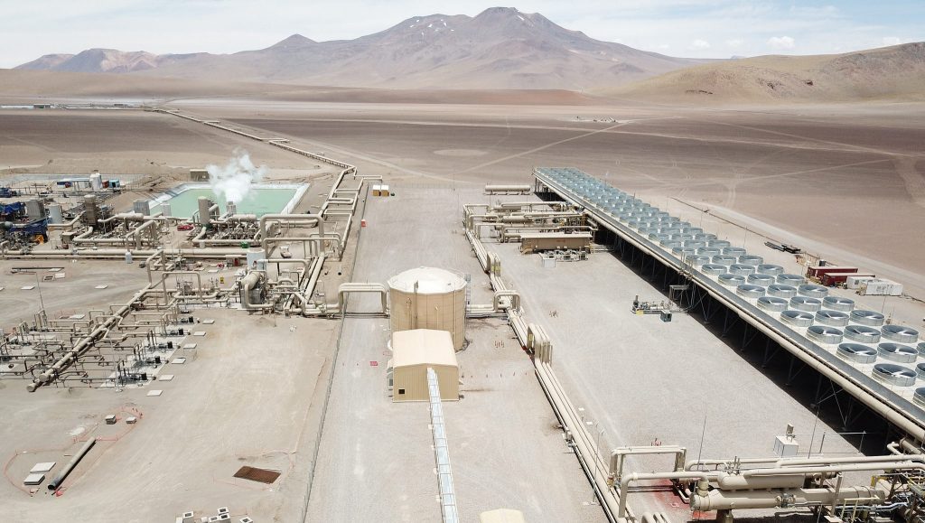
Image: Cerro Pabellon Geothermal Plant Chile [for main graphic for social media
Photo Source: ThinkGeoEnergy Flickr account: https://www.flickr.com/photos/thinkgeoenergy/albums accessed on March 10, 2019
About the author: Jason Fisher is a Geologist who has successfully worked as logging geologist in geothermal energy in Central America. Prior to geothermal energy, he worked as a Consultant on hydrogeology, oil and gas and environmental projects; and a lecturer in hydro- and physical geology. He is dedicated to the exploration and development of geothermal energy globally. You can find Jason on LinkedIn and Instagram @isleofrocks30.